Laird Lake Gold Property
REGION
Red Lake
SIZE
4972 Hectares
NUMBER OF CELLS
259
STATUS
Unavailable
TARGET COMMODITY
Gold
ACTIVITY
Grassroots Prospecting, Diamond Drilling
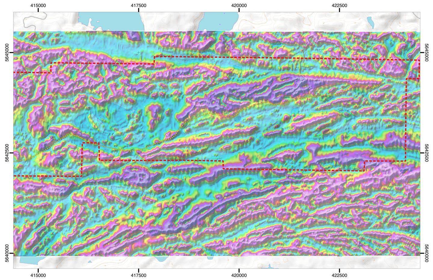
The 4,972 hectare Laird Lake Property Bounty Gold Corp’s flagship property. The Laird Lake Property is cut by a 500m wide NE-SW trending deformation zone, postulated to be an extension of the Flat Lake-Howey Bay Deformation Zone, host to the ~2.4M ounce Madsen Mine.
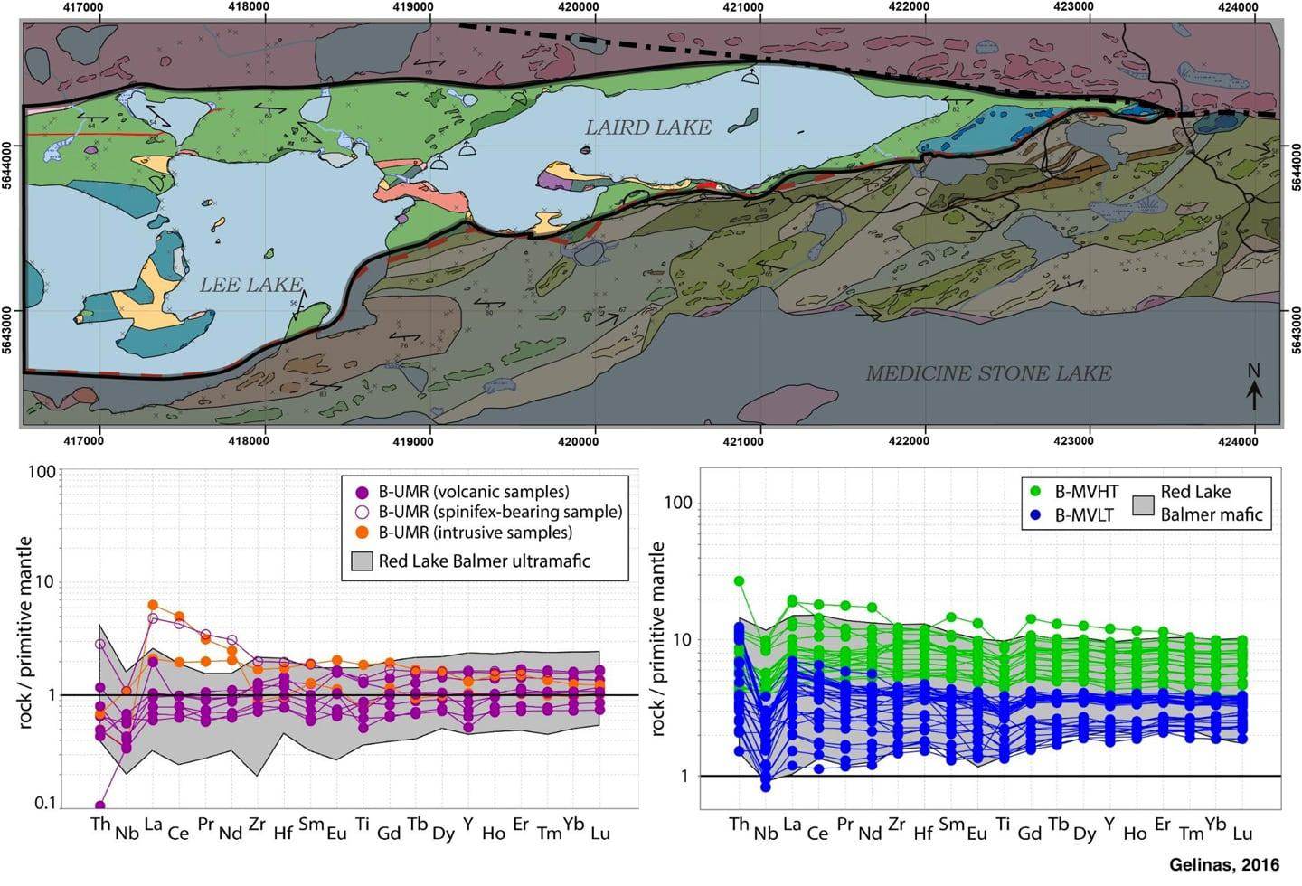
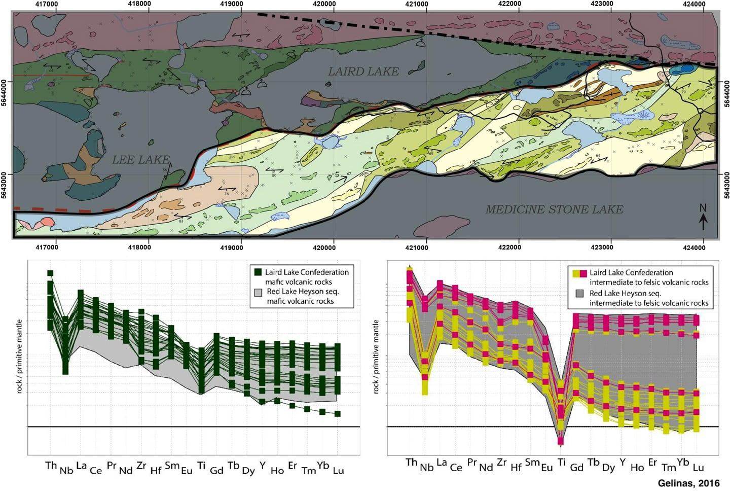
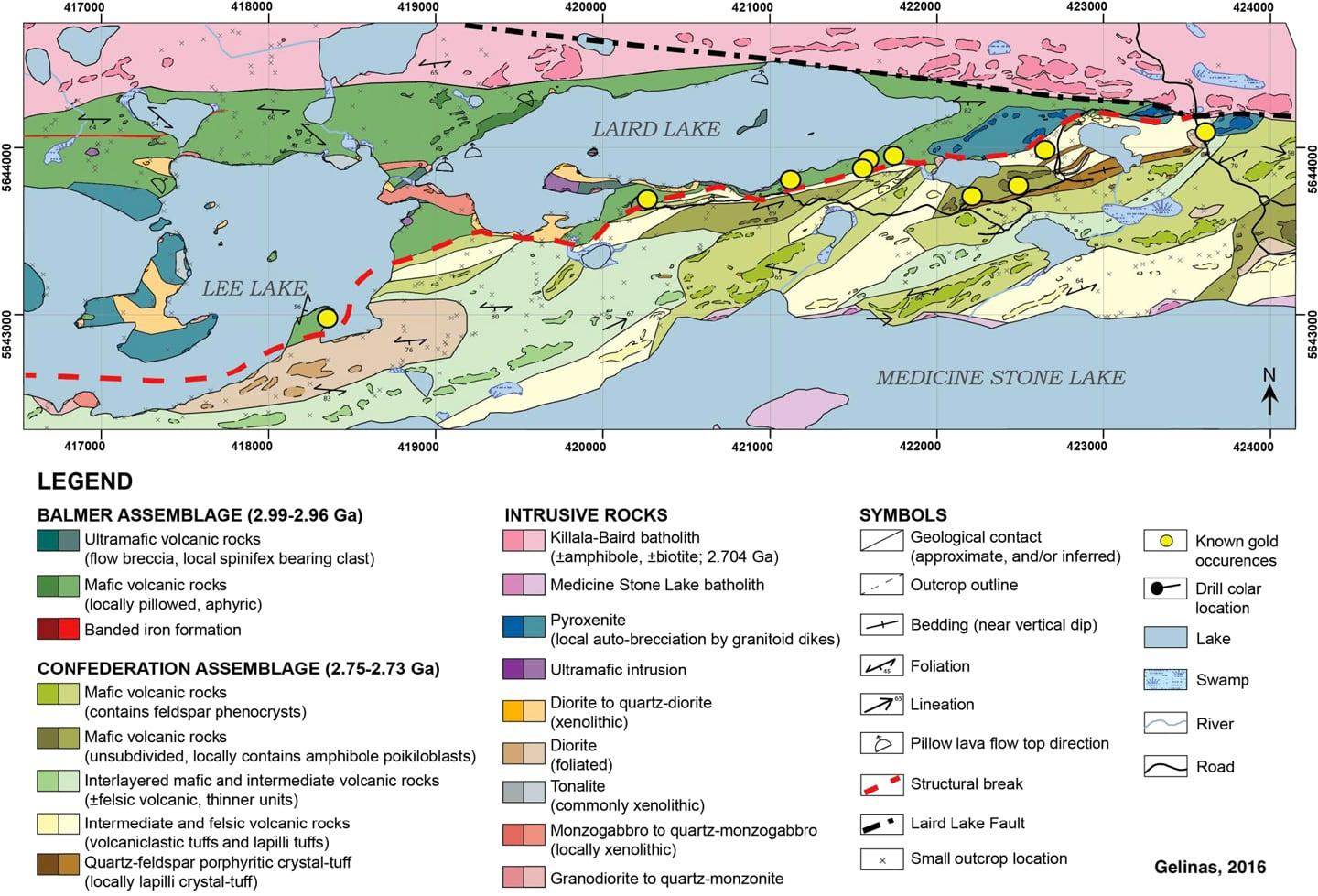
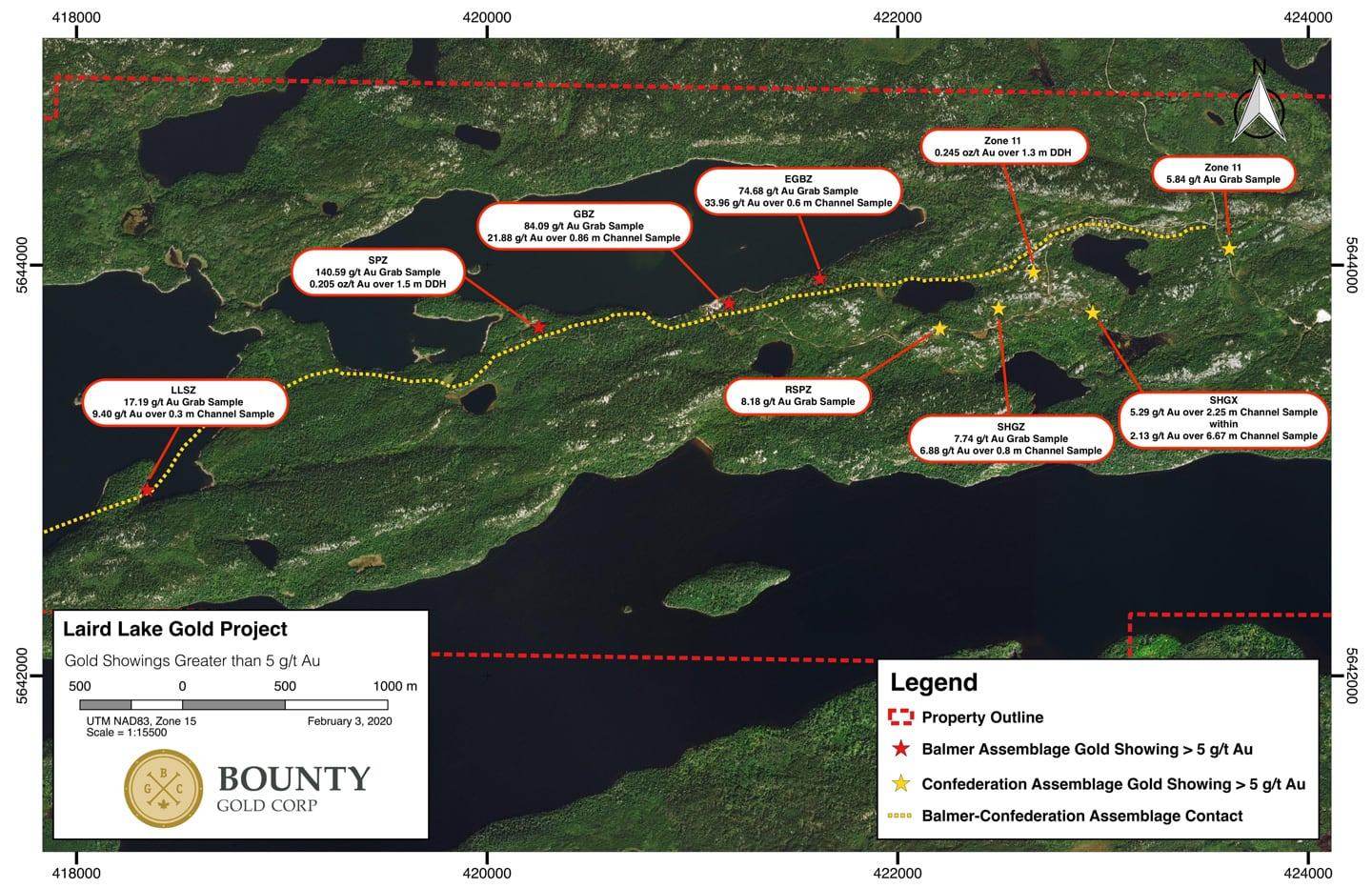
The intense magnetic high underlying Laird Lake is interpreted to be ultramafics, which are found on shore where these magnetic features breach the water surface, and now confirmed by diamond drilling. Nine occurrences of gold grading higher than 5 g/t Au have been identified in quartz and highly altered mafics, siliceous exhalite & iron formation in the Balmer Assemblage, and within sheared intermediate dikes and felsic volcanics in the Confederation Assemblage. These occurrences extend along a 3 km strike, and all occur within 500 meters of the Balmer-Confederation Assemblage contact. 90% of gold historically mined from the Red Lake District has been mined from within 300 meters of this important geological contact. The data obtained by Bounty Gold Corp at our Laird Lake Property suggest deformation and mineralization has been concentrated along this contact as it has elsewhere in the Red Lake Greenstone Belt.
We believe the Laird Lake area may represent an unrecognized extension of the Flat Lake-Howey Bay Deformation Zone. Historic mine plans of the Starratt Olsen Mine indicate the ore zones were lost to the south at depth, truncated by a major regional fault. There is growing geophysical and field evidence that this major regional fault displaced the extension of the zone ~13 km to the west (to the Laird Lake Property).
The latest information suggests the presence of a second WNW trending deformation zone recently discovered within the Confederation Assemblage. The Zone 11, SHGX, SHGZ and RSPZ gold zones appear to be associated with this structure. This structure is anticipated to intersect the NE-SW trending Balmer-Confederation contact and similarly trending deformation zone, further along strike to the WNW.
Prospecting, mechanical stripping and diamond drilling has identified four zones over ~3 km, with grab samples assaying up to 140 g/t (4 oz/t).

